SMART: Scotian MARgin Transects
Dalhousie University and Geological Survey of Canada - Atlantic
Funded by the NSERC Special Research Opportunity fund and the Geological Survey of Canada - Atlantic
When continental lithosphere rifts apart and new ocean basins form, a transition region is created between the old, thick continental crust and young, thin oceanic crust. Studying the structure of such continent-ocean boundaries provides direct observational constraints on the nature of rifting processes. Such studies also have direct commercial importance, since the investigated structures play a critical role in the formation of hydrocarbon deposits during subsidence and burial of the sediment. Two primary classes of rifted margins, volcanic and non-volcanic, have been recognized based on the amount of volcanism that occurs during continental break-up. The Nova Scotia rifted margin is located in a unique position bounding volcanic margins to its south and non-volcanic margins to its north. Recognizing the opportunity to investigate the controls on this first order change in the rifting style, Dalhousie University, funded by the Natural Sciences and Engineering Research Council of Canada, and GSC - Atlantic launched the MARIPROBE Program (1999-2004) that resulted in three SMART (Scotian MARgin Transects) wide-angle refraction OBS profiles crossing the Scotian margin (Figure 1).
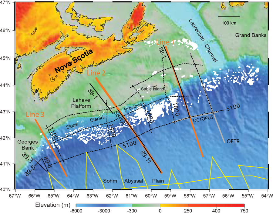
Figure 1. SMART OBS Lines 1-3 are shown with thick solid orange lines together with the location of other select regional seismic lines offshore Nova Scotia. MCS reflection lines are shown as solid black lines (Lithoprobe and Frontier Geoscience Program), dashed black lines (NovaSpan Project of ION-GXT), and yellow lines (UNCLOS Project). OBS refraction profiles are marked by gray lines (OCTOPUS and OETR). Jurassic salt over the Slope Diapiric Province is indicated by white patches.
The SMART survey was conducted in 2001 on CCGS Hudson (Figure 2). About 20 short-period 4-C ( three 4.5 Hz geophones and a hydrophone) OBS from the Geological Survey of Canada and Dalhousie University were deployed along each line. Instrument spacing varied from 40 km on the shelf to 20 km in the deep basin. The seismic source was a tuned air gun array with a volume of 104 L, which was fired once per minute at an average ship’s speed of 4.3 knots, resulting in an average shot spacing of 132 m. Data from Lines 1 and 2 were fully analyzed using a layered velocity modeling approach with RAYINVR software (Funck et al., 2004; Wu et al., 2006). Only a preliminary analysis of data from Line 3 was carried out.
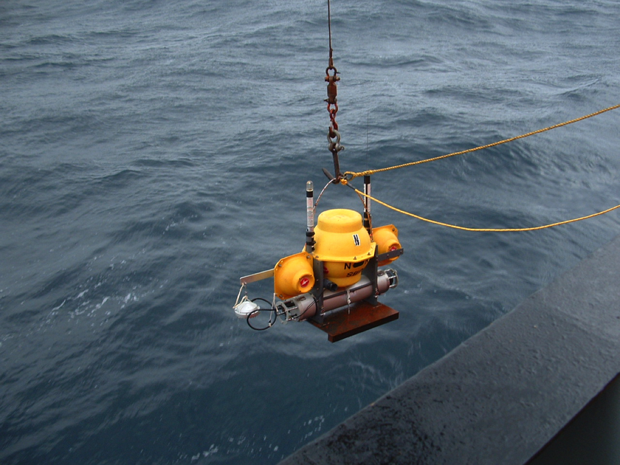
Figure 2. Deployment of the Geological Survey of Canada and Dalhousie University OBS during the SMART survey.
The data analysis results show significant variations in rifting style along the margin: (i) a volcanic-type margin in the southwest; (ii) a non-volcanic margin in the centre, with a sharp boundary between highly faulted continental crustal blocks and oceanic crust; and (iii) an extremely amagmatic margin in the northeast, with exposed mantle within the continent-ocean crustal transition and very thin oceanic crust seaward. These zones of transitional crystalline crust appear to coincide with northward transitions within overlying sedimentary structures, from salt-free to salt bodies in the southwest and from autochthonous salt diapirs in the centre to allochthonous salt tongues in the northeast.